Planning and operational reports
The RESEC method
Your mission starts before take-off.
By the time the drone arrives at your farm, a vital part of the work is already done. We have studied the site, planned the operation and organised the resources needed to deliver a precise, well-organised and documented service.
Developed in-house
Proprietary software. Expertise built in the field.
- Software engineers
- Agronomists
- Pilots
At the heart of this work is Mission Controller, RESEC's proprietary planning software, developed in-house. It brings together our specialist software engineers, agronomists and pilots: the people who build the tools, understand crop needs and deal with real flight conditions every day.
These skills come together in a system built around the way we work. Agronomic decisions become mission parameters; terrain characteristics become operational guidance; pilots' experience informs estimates for timing, refills and team organisation.
For your farm, this means entrusting the work to a company that also designs the technology used to prepare its operations.
Before take-off
How your mission takes shape.
-
We start with your farm's characteristics.
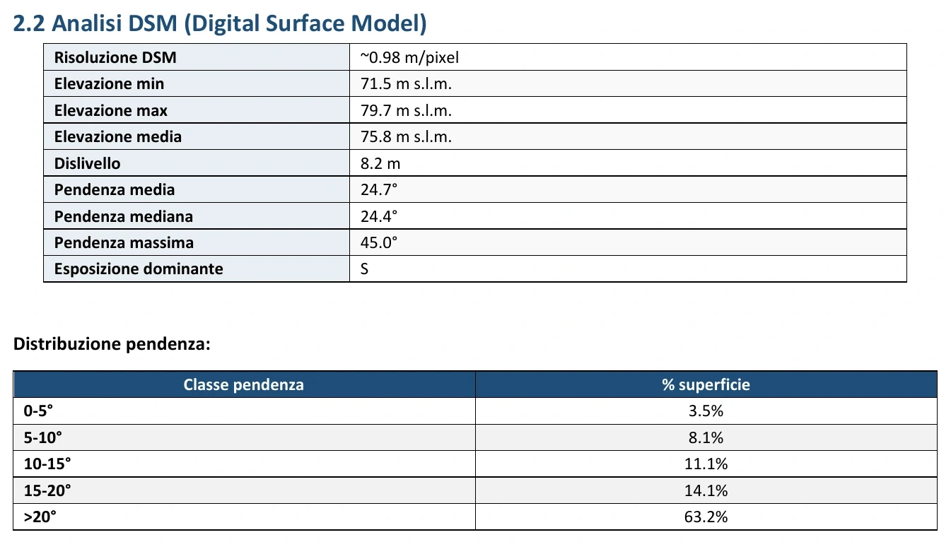
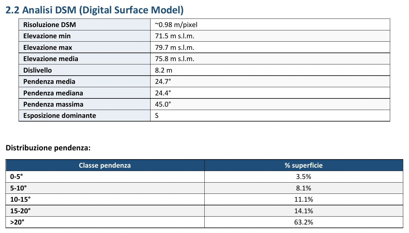
The plan starts with the areas to be worked: boundaries, plots, greenhouses and access points. The software processes their geometry and surface area. Where photogrammetric surveys are available, it integrates orthophotos and digital surface models to analyse elevations, height differences and slopes. Each operation is sized to suit the site where it will take place.
For you: preparation that matches the size and complexity of your plots.
 Enlarge
 The terrain becomes part of the plan. -
We also prepare the pilot's work.
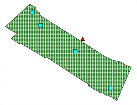
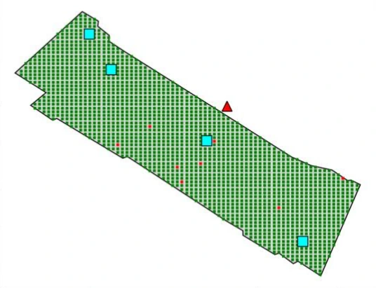
Mission Controller proposes or checks take-off points, considering distances, access and obstacles in the source data. Using the 3D model, it can simulate drone visibility and suggest positions from which the pilot can keep it in sight. The result guides on-site checks and helps identify areas needing closer attention before flight.
For you: potential issues addressed during preparation and a team arriving with clear operational guidance.
 Enlarge
 We also plan the pilot's viewpoint. Pre-mission report. Field visibility simulation: green marks areas visible in the model, red marks areas that are obstructed or out of range; squares indicate pilot stations.
-
We turn the operation into a work plan.
Agronomists and pilots define the treatment and parameters. The software relates dose, speed, altitude and swath width to the area to be worked. It uses these data to estimate mixture or material quantities, loads, take-offs and flight times, including any repeated passes and transfers between the refill point and work area.
For you: requirements calculated in advance and targeted preparation of products, water and equipment.
-
We organise everything that makes flight possible.
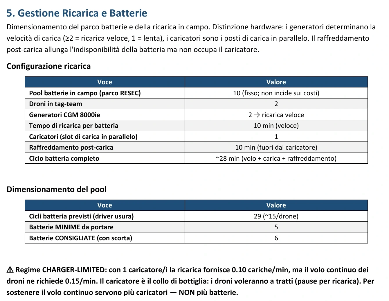
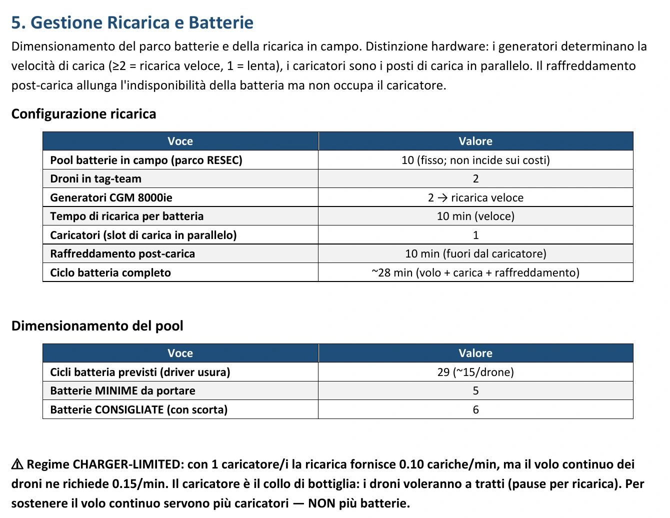
Batteries, charging, generators, refills, staffing, site setup and travel: the plan also accounts for ground work. It estimates the total workload, adds a time allowance and flags when multiple days are needed. It can also highlight insufficient charging capacity, helping the team adjust its organisation before departure.
For you: a more complete time estimate and a lower risk of interruptions caused by insufficient resources.
The mission takes shape in the field. Drones and equipment in the operating area, filmed by our operators.
 Enlarge
 A constraint identified before departure. Pre-mission report. The plan flags that the proposed charging capacity cannot sustain continuous flight for both drones: a concrete issue to address when preparing the mission.
 Enlarge
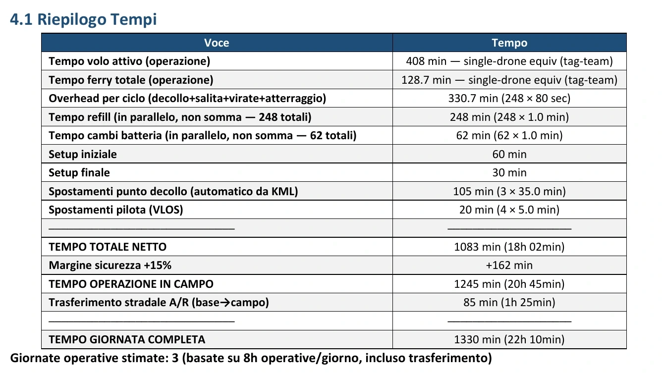
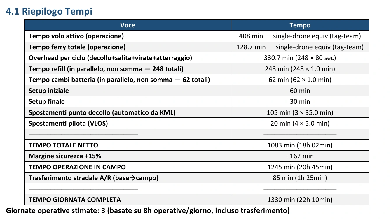
 Flight time is only part of the work. Pre-mission report dated 27 July 2026, page 12. The estimate separates flight, refills, battery changes, preparation, travel and time allowances. In this example, the work is planned over three days.
From real reports
Ground time is part of the mission too.
Site setup, refills and travel all take time. The plan makes this visible before the team departs.
These extracts come from two different plans. They do not show before and after the same operation.
-
We bring a plan to verify on site.
The pre-mission report brings together maps, parameters, requirements, estimates and warnings. The checklist supports material and equipment preparation and prompts checks on weather, airspace and documentation. The team confirms actual conditions before starting and adapts the operation when needed.
For you: prepared decisions and clear operational responsibilities, even when conditions change.
Better organisation for us. Greater clarity for you.
You know what we are preparing, can better coordinate activities on your farm and have a contact who understands the resources needed. Planning helps reduce avoidable waste and waiting, while the final report provides a record of the work completed.
See what you receive after the operationAfter the operation
When the work is complete, the data stays with your farm.
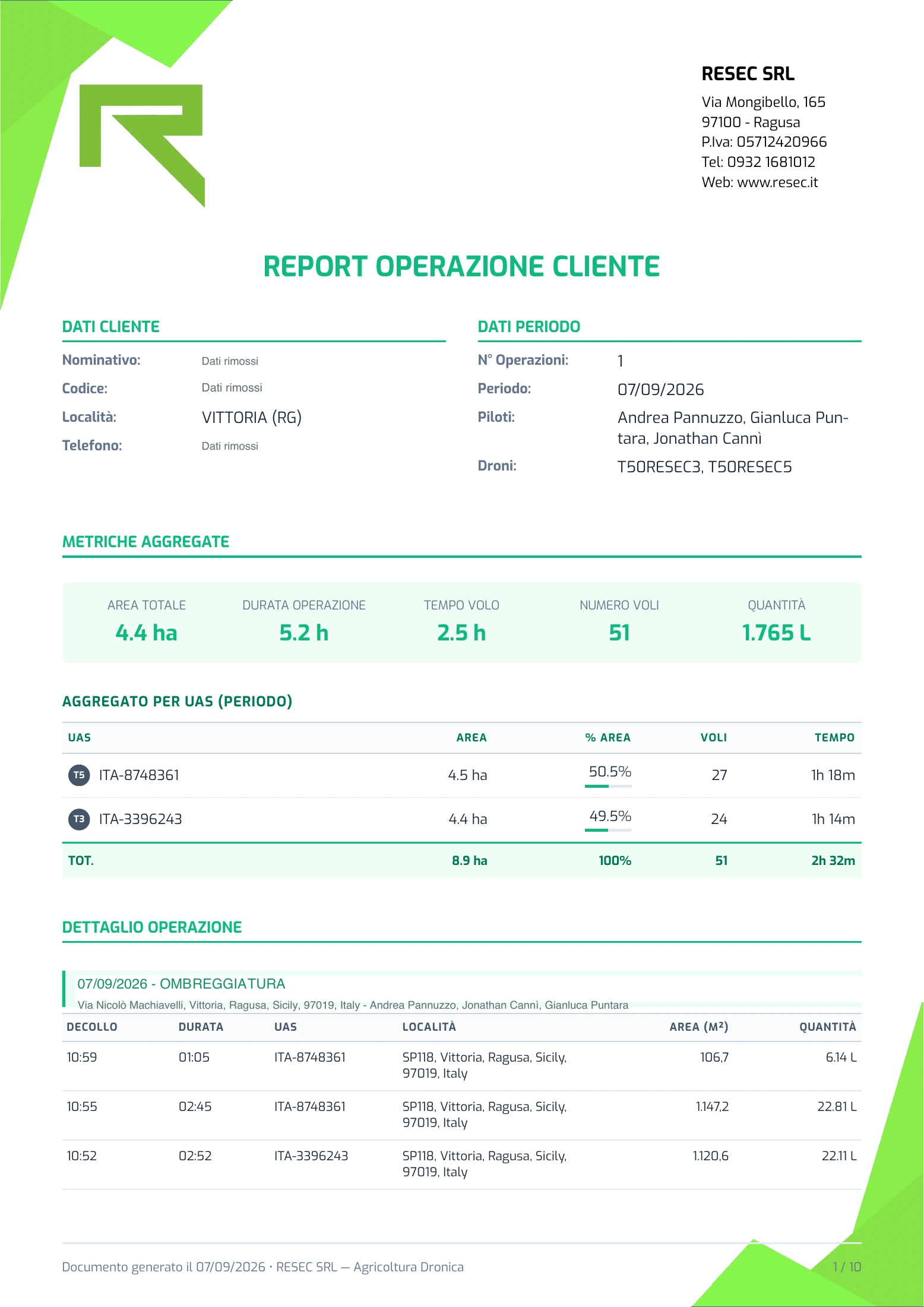
The service continues with delivery of the operational report. Data recorded during flights becomes a document you can keep, consult and share with your agronomist.
- An overview of the operation
- Dates, operation type, farm and work-area references, team and drones used.
- The figures behind the work
- Reported areas, number of flights, flight time and quantities applied, with summaries by operation and, where included in the report, by drone.
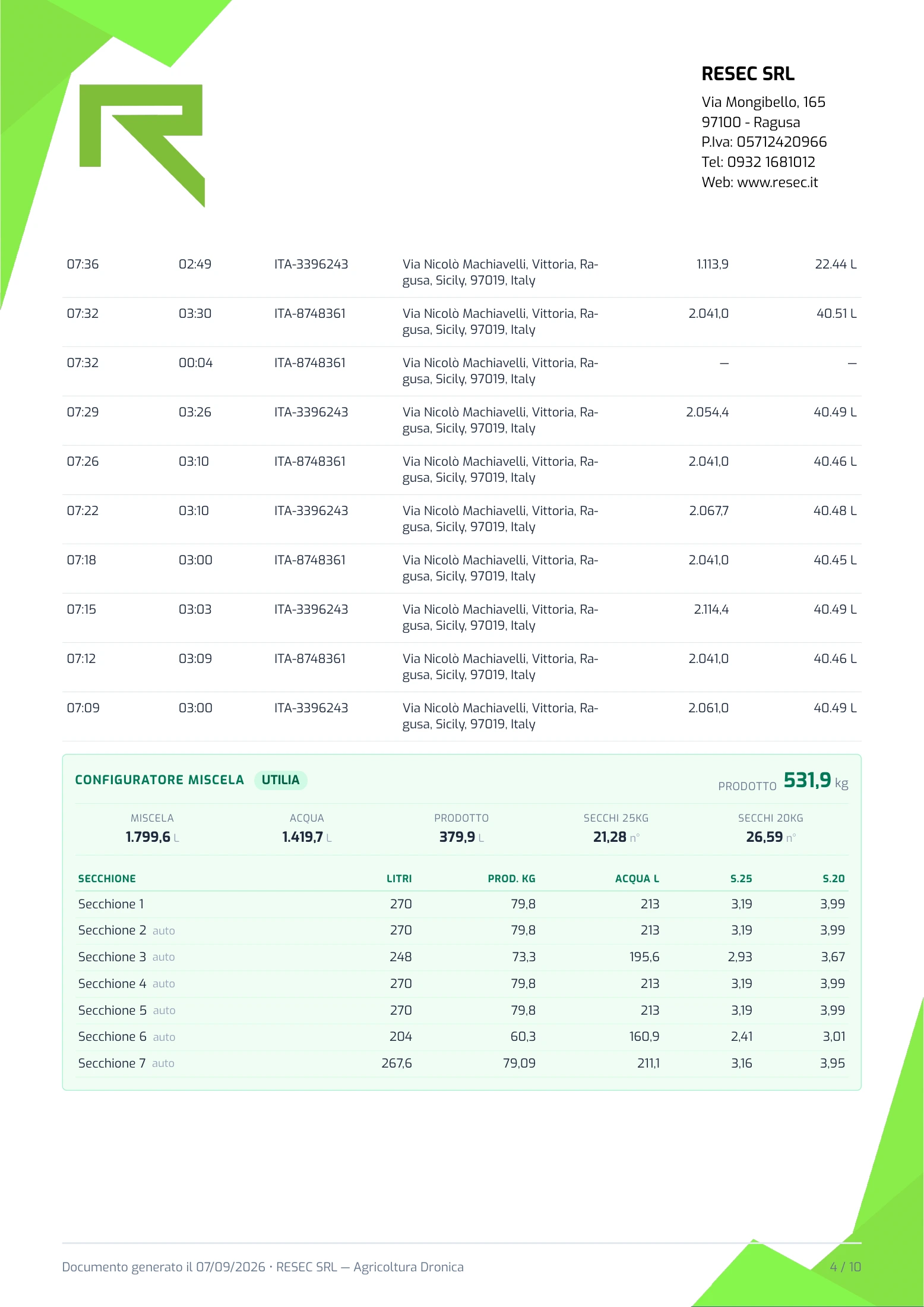
- Flight-by-flight detail
- Take-off times, duration, area and quantities recorded for each flight: information you can consult after the work is complete.
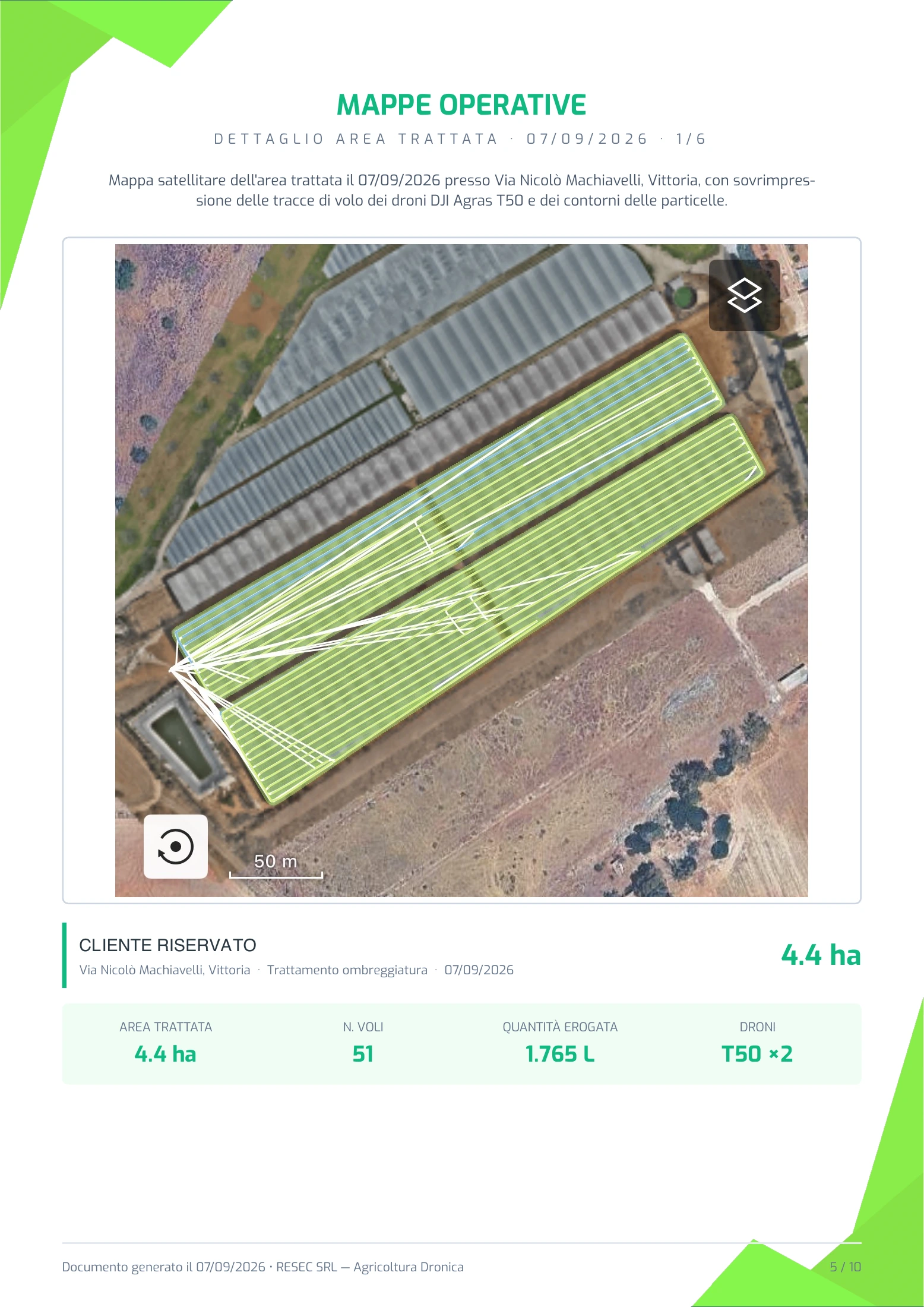
- Operational maps
- Where mapping annexes are included, reports show the worked areas with plot boundaries and flight tracks. A visual reference for understanding where the work took place.
When the technical summary includes a prescribed dose and a reference area, Mission Controller can also compare the actual average dose with the planned dose and report the deviation. This supports technical discussions with the agronomist.
 Enlarge
  Enlarge
  Enlarge
 From preparation to the final report, every stage leaves useful information. This is how we turn technology, agronomic expertise and flying experience into a professional service for your farm.
Tell us about the areas to be worked and the result you want to achieve.
Extracts from real reports covering different operations. Pre-mission screenshots show estimates and simulations; final report screenshots show recorded results. Values relate to these individual examples. Names and coordinates are excluded from the pre-mission extracts; the final report dated 7 September 2026 is shown with the customer's name, code and telephone number removed. Locations, mapping and tracks remain those of the actual operation. Original documents are in Italian.